Be Informed

Everyone has a role to play in flood readiness by being informed, planning ahead and taking action when the time comes.

Local businesses, organizations, schools, hospitals, and every single member of the community should have their own plan to be safe and to manage the risk and mitigate the damage should a flooding disaster occur. Here you will find recommendations on how to protect yourself, your loved ones and your property with detailed steps to take now so you can act quickly when the next flood is upon us.

For more information please see our Frequently Asked Questions section or contact us at floodreadiness@drumheller.ca

Our History of Flooding

History tells us that Drumheller Valley was carved by raging torrents at the end of the last ice age. As the water sliced deep through the Great Plains, it eroded through 75 million years of geological layers and created the Canadian Badlands, and we are at the heart of it.

Drumheller has seen its fair share of adversity from mother nature in terms of flooding. Over the years, the Town has seen several major floods:

June 27, 1915 (rain on snowmelt)
June 18, 1931 (rain on snowmelt)
April 21, 1948 (ice jam)
August 26, 1954 (rainfall)
April 2, 1997 (ice jam)
June 23, 2005 (rain on snowmelt)
June 21, 2013 (rain on snowmelt)
April 24, 2018 (ice jam)

Many of these floods resulted in declaring States of Local Emergency (SOLE).

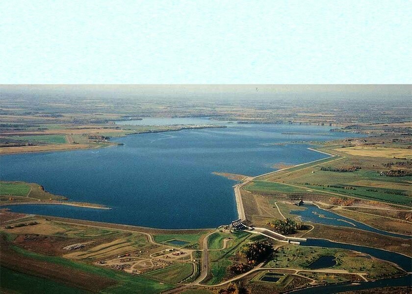
Dickson Dam

Originating in the Rocky Mountains of western Alberta, the Red Deer River flows eastward through aspen parkland and prairie. Near the Saskatchewan border, the Red Deer joins the South Saskatchewan River to eventually empty into the Hudson Bay. 

Mountain snowmelt and periodic rainstorms in the late spring and early summer combine to produce high flows from May to August. During the rest of the year there is considerably less water, particularly in the coldest part of the winter. This annual cycle of high and low flows can be extreme – from a record flow of 2300 cubic metres per second to flows as low as 2 cubic metres per second.

When the river was little used by man, natural variations in the flow created few problems. But as communities and industries grew along the river, the year-round demand for water increased. Residents became increasingly concerned about the quality of water, particularly when the flows were low.

A dam was proposed as a way of providing additional water in the river during periods of low natural flow. Technical studies began in 1971 and after a series of public hearings, a decision was made in 1976 to build the Dickson Dam. The primary purpose of the dam is to provide an assured, year round water supply to downstream users.

Overhead photography of the Dickson Dam, Drumheller
Dickson Dam

Understanding Flooding in Drumheller

Drumheller has experienced flooding since the ice age. Science tells us very clearly that Drumheller will be subjected to more frequent increases in temperatures, higher amounts of precipitation, and an increase risk of extreme weather as a result of warmer temperatures. Every flood situation that impacts the Town puts our heritage at risk along with risks to public safety, property, the environment and local economy.

The area at risk of future flooding in Drumheller is 100 km of riverbanks which includes our neighbourhoods of Nacmine, Newcastle, Midland, North Drumheller, Downtown Drumheller, Riverview, Rosedale, Wayne, Aerial, Cambria, Lehigh, East Coulee and Western Monarch, which can all be impacted by the Red Deer River, the Rosebud River and Michichi Creek.

Cause of Flooding in Drumheller

Ice Jams (Frozen Water)

These jams result from the accumulation of ice fragments that build up to restrict the flow of water and then act as a temporary obstruction. Jams form during both the freeze-up (October to November) and break up periods (March to April) but it is usually the breakup jams that have the greater flooding potential in Drumheller.

Rain on Snowmelt Runoff (Flowing Water)

During the winter, most of the precipitation is stored as snow or ice on the ground. During the spring melt, huge quantities of water are released which explains our heavy spring runoff and recurring flooding. This is called a freshet. These floods generally occur in the spring but can also occur during sudden winter thaws. Heavy runoff results from the rapid melting of the snow under the combined effect of sunlight, winds and warmer temperatures. When the ground is frozen, the water produced by the melting snow is unable to penetrate and runs off over the ground surface into rivers and streams. If there is an above average snow depth, a sudden thaw, or both, then the potential for high volumes of runoff and subsequent flooding increases. The situation can become of even greater concern if the rising snowmelt runoff is compounded by runoff from heavy rainfall. The later the thaw, the more likely this situation will prevail.

Rainfall (Falling Water)

Flash floods can be extremely dangerous. They usually happen on small watersheds as a result of a torrential downpour, often caused by heavy thunderstorm activity. A flash flood is characterized by the occurrence of the peak of the flood within six hours of the onset of rainfall. The flood conditions develop rapidly because the rainfall is so heavy the ground is incapable of absorbing the water quickly enough, resulting in a very high runoff rate. These events are generally locally intense and damage is usually restricted to a limited area.

Types of Flooding in Drumheller

Overland Flooding

Overland flooding happens when water overflows the Red Deer River, Rosebud River or Michichi Creek banks due to rain or extensive volumes of melted snow. This is a type of flood that results from the level of water outside of your dwelling rising, allowing water to enter your home.

Wastewater

Water on flooded streets or high groundwater may drain into the sanitary sewer system. This overloads the sanitary sewer pipes and can force sewage back through the sewer line and into your basement.

Stormwater

When the Red Deer River, Rosebud River or Michichi Creek rise, water can flow back into the storm water pipe system. Water may spill back onto streets or basements through stormwater drains.

The History of Drumheller Valley

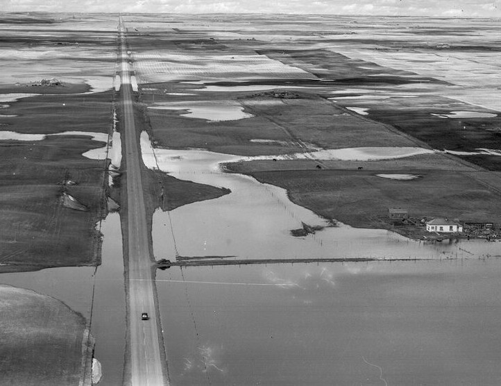
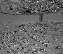
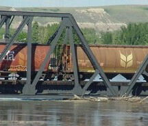
Images captured from major flood events in the Drumheller Valley history.